Treespot system to promote regions and trails

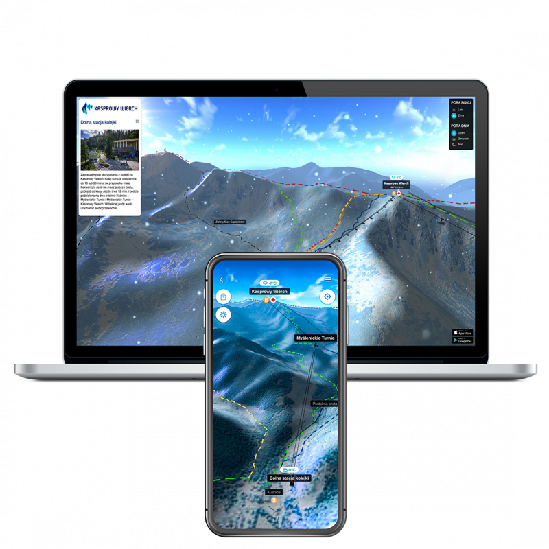
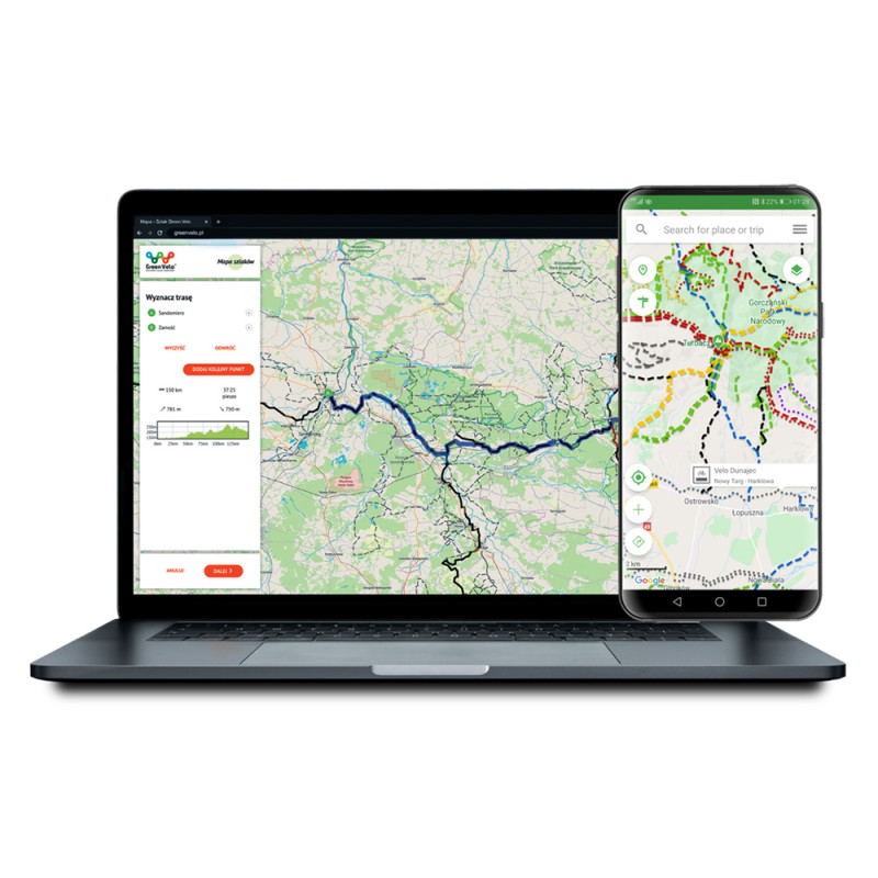
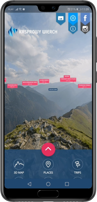
Make your region’s tourism and recreation stand out the right way.

Several dozen useful modules manageable with one CMS, common for all websites, applications and infokiosks. See below some examples of Treespot functionalities. You decide which ones you want to incorporate in your solution. We create a unique product adapted to the needs of your region!

3D map

  • ability to implement in the app or on www,
  • bird’s-eye view of trail,
  • possibility to see entire trail using just one click,
  • detailed information on different spots,
  • ability to change seasons and part of a day,
  • weather forecast for given areas.

Interactive network of trails

  • several thousand kilometres of trails,
  • trails divided by categories,
  • possibility to display several trails side by side,
  • recording tracks and marking own places,
  • sharing trails with other users,
  • receiving current weather info for any location,

Places and trails

  • OSM map background or Google Maps,
  • ability to view any monuments, natural sights and trails,
  • spots and trails are divided into different categories,
  • once a spot is added in CMS, it will also be visible in the application and on the website.

3D panorama

This feature enables you to place any 360º panorama in your app or on your website. It can be e.g:

  • a mountain landscape
  • city sights
  • building  interiors
  • tourist facilities

Archival pictures

Thanks to the Treespot module in which we can use archival pictures, a user can see how the place he or she is visiting looked like in the near and distant past. All you need to do is to stand in a given place and turn you phone on a chosen object.

Outdoor games

  • a combination of active recreation and exploratory tourism
  • riddles and exercises right on your smartphone screen
  • solving a mystery leads to a virtual award

Audioguide

Visiting can be even more pleasant now!

  • professional voice actors,
  • multiple language versions,
  • automatic (location-based) or manual modes,
  • audioguide deployable on mobile app mobile app and/ or on website.

Nature encyclopedia

  • mobile atlas of nature,
  • information on wildlife found in a given area,
  • photos, descriptions and audio recordings enable you to recognize animal species, trails or birds sounds,
  • ability to correlate with QR codes imprinted on trail signs

Most important projects:

3D map of Kasprowy Wierch for PKL, interactive network of trails in Małopolska and Mazowsze created for PTTK or 3D models of Bieszczadzki Park Narodowy app - these are just some examples of our innovative solutions.
Please see below projects for regions and trails that we’re the most proud of.

Models of cooperation


  Treespot
Mini
Treespot
Optimum
mobile app + website
CMS to manage contents
unlimited number of records in CMS (objects, routes, photos)
own map, Open Street Map, Google Maps
mobile apps in AppStore and Google Play
individual graphic design acc. to your needs limited (only color design and logo)
unlimited number of modules  
  read more read more


Every project is different, so we take an individual approach to each client. Contact us for a quotation on your project or to find out more.